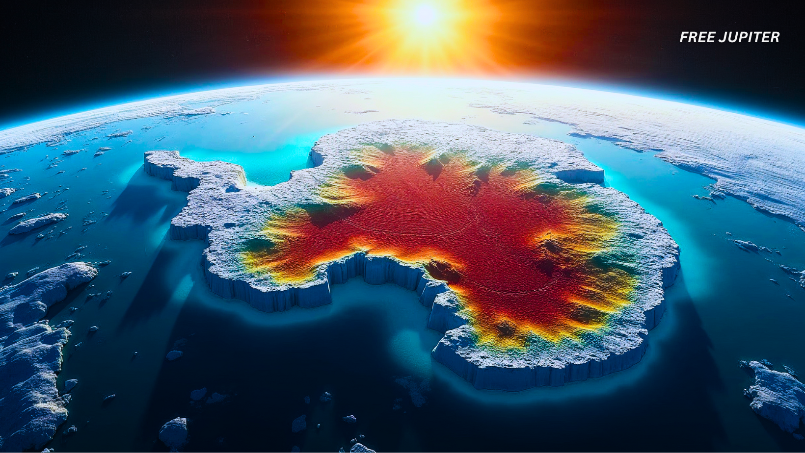
Deep beneath the icy surface of Antarctica, remnants of an ancient continent have recently been uncovered by scientists. For decades, the geological and geographical past of this frozen land remained a mystery. However, newly analyzed satellite data is now shedding light on its hidden history. These findings are revolutionizing the understanding of how Earth’s continents have shifted over time, helping scientists connect the dots between past and present land formations.
Antarctica was once part of a much larger landmass, joined with other continents in an ancient supercontinent. Over millions of years, these landmasses separated due to the movement of tectonic plates. The remnants of these movements are buried deep beneath the Antarctic ice, hidden from plain sight. The extreme conditions and thick ice sheets have made studying the continent’s geological history particularly difficult. Until now, much of what is known has been based on limited seismic data and indirect measurements.
The recent discovery has provided scientists with a clearer picture of the continent’s past. By analyzing gravity field data, researchers have detected variations in mass beneath the surface, revealing the structure of ancient land formations. These findings suggest that large portions of East Antarctica share geological similarities with Australia and India, indicating that they were once connected. The evidence supports long-standing theories that Antarctica was part of the ancient landmass known as Gondwana, which slowly broke apart millions of years ago.
Understanding this hidden past is essential not just for reconstructing Earth’s geological history, but also for modern scientific research. The land beneath the ice influences the stability of Antarctica’s ice sheets, which in turn affects global sea levels. As climate change accelerates, studying these geological features can help scientists predict how ice coverage may change in the future. The revelation of this ancient continent beneath Antarctica is a groundbreaking step toward solving some of the greatest mysteries about our planet’s past and future.
Satellite Technology Reveals the Truth
This remarkable discovery was made possible through a gravity-mapping satellite. Interestingly, the satellite that provided this crucial data has not been operational for several years. Despite this, its information continues to be invaluable to researchers, proving that even after a satellite’s mission ends, the data it gathers can still provide significant discoveries for years to come.
The satellite, known as the Gravity Field and Ocean Circulation Explorer (GOCE), was operated by the European Space Agency (ESA). Launched in 2009, it functioned for four years before being decommissioned in 2013. GOCE’s mission involved mapping Earth’s gravity field with incredible precision. The measurements it recorded allowed scientists to analyze variations in gravity caused by differences in mass beneath the Earth’s surface. Although the satellite is no longer in orbit, the data it gathered is still being analyzed, offering new insights into Earth’s lithosphere—the outermost layer of the planet’s geology. This information is critical to understanding Earth’s structure and how continents have evolved over millions of years.
Read more: Gargantuan Ancient Forest Found 630 Feet Below Ground In Massive Chinese Sinkhole
Groundbreaking Insights into Antarctica’s Past
According to Fausto Ferraccioli, a geophysics expert with the British Antarctic Survey, these gravity images have significantly advanced the study of Antarctica. The least understood continent on Earth is now being explored in ways never before possible. Scientists can now study the continent’s sub-surface structures with greater accuracy, revealing features that have remained hidden for millions of years.
Researching the land beneath Antarctica has always been challenging. Thick ice sheets have long concealed the geological features below. Traditional methods of exploration, such as drilling or seismic surveys, have been difficult due to extreme conditions and logistical challenges. However, the satellite data has helped researchers reconstruct Antarctica’s past and understand where it was positioned millions of years ago. By examining these hidden landforms, scientists are uncovering more details about Antarctica’s origins and its connection to other continents.
The Evolution of Antarctica Over 200 Million Years
A study detailing these findings was published in Scientific Reports, outlining Antarctica’s geological evolution over the past 200 million years. A brief animation was also created, illustrating how the continent gradually separated from an ancient supercontinent known as Gondwana. This research provides a clearer picture of how Antarctica and its neighboring continents were once part of a massive landmass that has since fragmented over time.
The video highlights how, around 180 million years ago, Gondwana started breaking apart. The landmasses that once formed this vast continent eventually drifted into their current locations, becoming what is now India, Australia, and Antarctica. This continental drift has played a crucial role in shaping the Earth’s geography and continues to influence geological processes today.
Read more: Unraveling The Mystery Of The Indian Ocean’s ‘Gravity Hole’
Unveiling Antarctica’s Ancient Structure
Beneath East Antarctica, an intricate geological mosaic was detected. Scientists observed fundamental similarities between its crust and the continents it was once connected to. This discovery provided a clearer understanding of Antarctica’s ancient structure and how it fits into the larger puzzle of Earth’s geological history.
Cratons, which are ancient fragments of continental plates, were found deep below the Antarctic ice. These same structures have been identified in Australia and India, confirming that East Antarctica was once linked to these regions. Cratons are among the oldest parts of Earth’s crust, acting as geological time capsules that preserve the history of Earth’s formation. Their presence beneath Antarctica further supports the idea that this continent was once part of a much larger landmass.
In contrast, no cratons were observed beneath West Antarctica. This absence suggests that its lithosphere is significantly thinner than that of its eastern counterpart. West Antarctica is known to have a more dynamic geological structure, characterized by younger, more fragmented landmasses. The differences between East and West Antarctica highlight the diverse geological processes that have shaped the continent over time.
Read more: Secret CIA Files Say That The Ark of the Covenant Does Really Exist And They Know Its Location
Impact on Climate Research and Future Studies
The discovery of this hidden continent is more than a glimpse into the past. It also plays a crucial role in understanding how Antarctica’s geological composition influences its ice coverage. The stability of ice sheets is directly linked to the land beneath them. A deeper understanding of Antarctica’s geological structure can help scientists predict how these ice sheets will respond to future climate changes.
As climate change accelerates, Antarctica’s ice sheets are becoming increasingly vulnerable. The geological features beneath the ice influence how glaciers move and melt. By studying these formations, researchers hope to predict how the ice sheets may respond to rising temperatures. This information is essential for assessing global sea level rise and the potential impact on coastal regions worldwide.
As scientists continue to analyze satellite data, new revelations about Earth’s ancient past are expected to emerge. The hidden remnants beneath Antarctica serve as a reminder that much of our planet’s history is still waiting to be uncovered. With advancements in satellite technology and geophysical research, more discoveries about Earth’s past and its evolving landscapes are likely to come to light, reshaping the understanding of our planet’s dynamic history.


